The Million Dollar Highway experience, two amazing hikes, and Great Sand Dunes National Park!

After four days of withering away in the hot, dry desert of the Comanche National Grasslands, we were beyond ready to get to the cool mountain camping we'd been dreaming of since Florida. We left early with snow-capped mountains on our minds and a long trail of dust settling behind us.


The roads were winding and sometimes pretty steep, but the truck did a great job and the views were breathtaking! We passed near the stunning Spanish Peaks entering Rio Grande National Forest.

What a huge change in just a few hours of driving - from dusty desert to lush, green, alpine meadows. Scraggly cacti were replaced by huge red pines & bold white aspen trees with bright green leaves.


Our dusty grasslands hike had been at 4,320 ft. elevation. Here, we climbed mountains over 12k ft. and even got to play in the SNOW!

The steep inclines and sharp curves weren't the only thing that made mountain driving tough. We had to do our own map recon and be cautious trusting the GPS. Sure, the suggested road may go to your destination, but it won't warn you that you need high clearance and 4WD to get down that road (and better not be towing anything!). We have a very capable truck but, at least while we're towing the camper, the terrain really dictates the journey. The local vehicles were mostly trucks or jeeps. There were also ATV/Jeep rental shops on what seemed like every corner.


We found a great spot in the Rio Grande National Forest near the city of South Fork. Fox Mountain Road follows ice-cold Park Creek, and spaced out along it are grassy sites where you can camp for free, up to 14 days.


Traffic was fairly quiet, other than ATVs passing by. We had a beaver for a neighbor and caught brown trout in the creek. This was my first experience camping at high altitude, around 10k feet. The air felt really fresh but thin, and any physical activity would make us out of breath at first.


Not only is the landscape tough, the weather is crazy in the mountains. There were many times that the forecast said clear and sunny and it ended up snowing! One random severe thunderstorm shook the camper with 70 mph winds and we could feel the slide lifting up under us. The wind also picked up and flung our plastic propane-tank cover into the creek! It floated downstream a few hundred yards but Kyle spotted it a few days later and got it back.
 | |
|
We also had some surprise hailstorms while driving, which could be pretty intense!
Snow melt and the frequent rainstorms kept everything looking lush and green, but most of the state was currently under a fire ban. We saw vast areas of blackened burnt trees on the mountains and imagined how difficult it would be to fight a fire of that size on these sketchy roads.

For those brave enough to deal with it all, there are endless opportunities for exploration and adventure. You'll find stunning views of nature in any direction.


We explored pristine alpine meadows watching elk, chipmunks, moose, and marmots roam


We'd never seen marmots in person before, and Khaleesi was especially fond. They were everywhere, either scrambling among the rocks or sunbathing on them, and bigger than I expected.

There are historical markers and educational signs along the roads and we loved learning about the history of the land and people. Mining was huge here, and almost anywhere you look you'll see old equipment, abandoned buildings, and even buckets like these that the miners used to ride to work!


Down the road from camp we found Summitville Mine - Colorado's 3rd richest Gold mine. Driving along the main highway there were so many beautiful sights like Treasure Falls.

Here's another roadside waterfall with a bonus rainbow:

And this gem:

We've even seen bison grazing in pastures along the road just like cattle.
 |
| Royal Gorge near Canon City |

There are almost as many fishing opportunities out here as hiking trails. We explored Big Meadows Reservoir nearby with its huge waterfall and beautiful clear lake.


But, our trip to Million Reservoir was even better since we got to pet some friendly donkeys!! A group walked in with their donkeys alongside. When we cautiously approached they explained that this was a group of therapy donkeys and they loved to be loved on.

They also told us there would be a donkey race that next Saturday in a small town nearby called Creede. We did go to Creede on Saturday, but unfortunately the donkey race had been cancelled. They did have an underground firehouse/mining museum, and a bunch of cool abandoned mining buildings.


While researching our area, we found that the Crater Lake Trail head was 40 minutes down the gravel road we were camping on, and only a 3.4 mile hike in after that. Somewhere around 8 miles round trip didn't sound so bad, but with the mid-point of the hike being at 12160 ft., and the hardest part of the climb being near the end of the hike, it definitely tested our high-altitude hiking capabilities.

San Juan National Forest / South San Juan Wilderness - Crater Lake Trail
Elevation: Trail head: 11620 ft. Top: 12160 ft. Lake: 10910 ft. Length: Around 8 miles. Time: 7 hours.

The first half of the way in is a fairly steep incline taking you from 11,620 ft. at the trail head up to 12160 ft. at the top of the ridge earning some great views of the surrounding peaks.


Then, the path goes waaay down into the crater, where the lake rests at 10910 ft.. It took us about two hours to get to the lake. We passed 6 people along the way who were heading back out, but when we got to the water we had it all to ourselves.


The view of the snow-capped mountains nearby reflecting on the water was stunning, and after a quick glimpse in the water we were super excited to see a bunch of giant, colorful Colorado Cutthroat Trout swimming among the logs!


Of course Kyle had brought his fly-rod and got down to business casting. He even landed a giant one on a fly he tied!!


I'm still in awe at how gorgeous these fish were! We've seen a lot of trout (both in person and watching fishing videos) but I've never seen one as colorful as those we saw in Crater Lake.

We really should have brought a tent and camped out there, but after about an hour of fishing and resting, we had to head out. We were losing light and knew it'd be a difficult climb. The hike out of the crater was definitely the hardest part, and our legs were already tired from the hike in. It was really tough, but so so worth it.


And who would guess with all of that around us, we were only an hour from North America's tallest sand dune? Great Sand Dunes National Park was the "main event" - the main reason we picked our current location. The sand dunes are so big that you can see them for half an hour before you get to the park entrance, and they look so out of place in the shadow of the snowy mountains nearby.


There was a sign at the pay-gate when we arrived saying they weren't currently charging admission, so we drove on through. Remembering our previous desert experiences, we'd left early to get there with enough time to explore the dunes before it got too hot for puppy paws... and it ended up being too cold! We stepped out of the truck into cold, whipping wind and snow flurries to realize we'd then have to cross water to get to the dunes. We decided to wait until it warmed up a bit.
My friend Kate had been to the dunes before, and recommended hiking up to nearby Zapata Falls, so we headed that way for our morning adventure. The road up to the trail head is about 2 miles and one of the bumpiest I've ever been on. The truck crawled and bounced up toward the parking area, then we hiked about a mile to the falls.

 |
| See the chipmunk? |
The first view of the water is a wide, shallow, rocky creek flowing gently out of the slot canyon. To see the falls themselves, you have to wade through the ice water in between the rocks of the canyon.


We were so glad we'd worn our muck boots instead of hiking shoes like everyone else we passed. Most probably missed out on the real view, which I'm sure was a bummer after so much work to get up there.
We were warmed up from our hike, though the weather was still chilly, cloudy, and windy. It was now or never. We drove back to the dunes, and crossed the shallow creek.


There were probably over a hundred people of all ages and many dogs scattered like ants across the vast sandy hills, sledding/sand boarding or just roaming like us. The dunes were much bigger than we expected, and took a long time to climb.


The park contains the tallest dune in North America at over 750 feet, and many more over 700 feet tall. Overall, it wasn't the hot and sunny desert experience we pictured, but wandering among the giant dunes was magical, and Zapata falls was a great side trip.
Our two weeks in the Rio Grande were up, and it was time to move. We'd never heard of the Million Dollar Highway, but it's known as one of America's most scenic drives, and also on the list of "world's most dangerous roads". We got multiple recommendations for that area including a few towns along the way: Pagosa Springs, Durango, Ouray, & Telluride. We checked the map and aimed for a spot near the tiny mining town of Silverton. The drive was definitely an experience, both beautiful and scary. The narrow road winds through gorgeous mountains with jaw-dropping views, sharp curves, steep drop offs, and no guard rail to stop you.


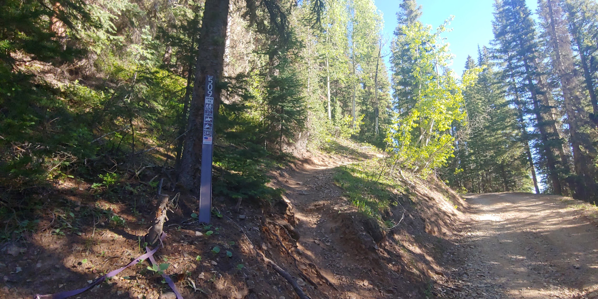
We were now in San Juan National Forest. The first spot we aimed for ended up being a little too crowded for our liking (more "campground" than "dispersed camping") but we found a better one a few miles down the road, on FSR 679. The road down to camp was pretty steep at first, but not enough to be a deal breaker. After we parked and got settled in, we researched the area and found out our new site was right beneath both the Columbine Lake Trailhead and the entrance to Ophir Pass!


On the map it looks like this site is right next to the highway, but it's actually way below it. We could barely hear the traffic passing overhead.

San Juan National Forest - Columbine Lake Trail
Elevation: Trail head: 10346 ft. Top: 12693 ft. Length: Around 7 miles. Time: 8 hours.

I thought Crater Lake had been a tough hike, but Columbine took the crown. This hike took 8 hours, not including the time at the lake. The first section is a narrow hard-packed dirt trail at a very sharp incline, turning back and forth over switchbacks as you climb up through the fragrant pines. Loose rocks and harsh angles made it hard to get footing sometimes, so it was slow progress. There were elk prints along the trail, and occasional delicate wildflowers to admire while we caught our breath, including the lake/trail's namesake - The Columbine.
 |
| Red Columbine |

 |
| Scarlet Indian Paintbrush |
 |
| Colorado Blue Columbine |
After three hours of climbing, the trees stopped and the trail lead through an open grassy meadow where the slope was more gentle. We stopped for a minute to take in the view, and it was so neat to see the tree line continue on the surrounding mountains.


As we stood there, we spotted a few people climbing up the trail below. So far, we were going to be the first ones up, so seeing them catching up to us motivated us to push on. The next task was climbing and crossing a scree slope...

then squishing through mud and hopping over ice cold streams to climb slippery snow banks.


The snow-melt streams grew as we climbed, and finally ended in a beautiful crystal clear waterfall pouring over a smooth rocky ledge, out of a still mostly frozen lake. And, we were even the first ones there!


All alone except a single marmot, we sat on a small hill nearby to rest our feet and take in the view.

We heard the ice sheets cracking a few times, but didn't see any movement from them. Everything was so quiet and still. The water was brilliant blue and cold with no life that we could see.
We stayed for about half an hour, laying in the sun & preparing ourselves for the long hike back. As we were lacing our shoes back up to leave, the party that was hiking in behind us showed up. One of them asked if we'd take their picture, and they took ours in trade.

We started our 3 hour hike back down around noon and, though this part was mostly downhill, it was not easy. Keeping our balance on the slick, steep slopes was even tougher after the morning's hike, and our knees and legs were shaking from the effort.


Throughout the second half of the hike, including the 5 guy party at the top, we saw 13 people and 3 dogs. The hike was full of gorgeous views and definitely a great workout. Even though the snow and melting runoff made it more difficult, it was really cool to experience a stunning and peaceful frozen lake on top of a mountain.
This area usually sees a lot of tourism from ski resorts, but unfortunately due to Covid, they hadn't been able to open for the season. Besides, it was late June and much of the snow had already melted. We did make sure to do at least a driving tour of Telluride, Ouray, Silverton, & Pagosa Springs.


All of them were adorable, each nestled in a lush green valley surrounded by stunning mountains. Some hang on to that small town feel and don't allow stores like Wal-Mart or Dollar General. It keeps everything feeling very classy, but also makes it all twice as expensive as anywhere else. They all had ATV/Jeep & cabin rentals on almost every corner. Silverton had great fishing, and in Telluride you can ride the gondola up the mountain for free. Check out this house on the side of a cliff near a waterfall! I bet the view from up there is epic.
I'll especially remember Ouray for our one-night hotel stay where we treated ourselves to a much needed bath, and even had a dog park next door to the hotel!

Pagosa Springs was beautiful and well developed without feeling crowded, but the springs are all privately owned so you can't see them without paying. I guess we'll just keep searching for those wild natural hot springs we've seen on Instagram.
After watching subarus/volvos and other lower-clearance vehicles than ours coming down the Ophir Pass, we figured our truck would do just fine. Almost the entire pass is a one-lane rocky road with a steep drop off on one side. We had to pass multiple vehicles during the trip which was probably the scariest part.


There were areas of the pass where we would not have been able to cross if we didn't have 4WD, but other than a slick scree crossing, it wasn't too bad overall and the views were totally worth it.
Colorado has been epic and everything we hoped it would be. From dusty desert to snowy mountains, we've been able to experience so much of this wild state already, and we aren't done yet! In July we'll be heading North into Gunnison National Forest (near Aspen) to fish the Taylor Park Reservoir and the Gold Medal waters nearby. But, I don't know if we will ever be able to top the beautiful Colorado Cutthroat Trout from Crater Lake.
*If you are reading this in the email version, make sure you go to https://telastravels.blogspot.com/ to see the full post including videos!*
